Scarborough Marsh
About
GENERAL INFORMATION
Criteria:
- Listed on more than one “valuable wetland” list by natural resource agencies or nongovernment organizations.
- Supports significant numbers of wetland-dependent fauna, such as water birds or fish
- Rare or unique wetland type within its own biogeographical region
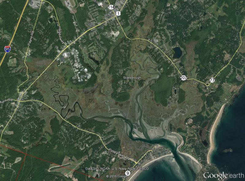
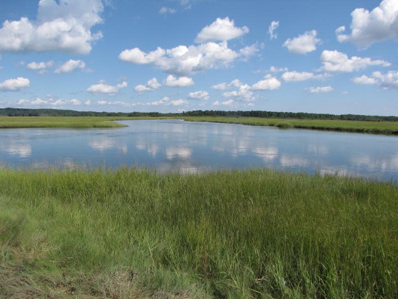
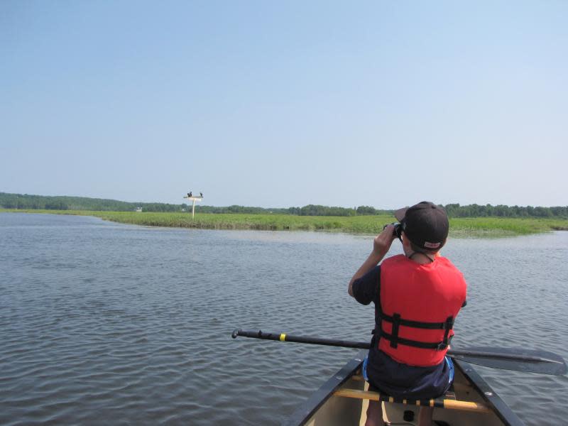
Owned and managed by the Maine Department of Inland Fisheries and Wildlife, the Scarborough Marsh Wildlife Management Area covers over 3,000 acres of tidal marsh, salt creeks, freshwater marsh and uplands. The protected area includes approximately 2,700 acres of salt marsh, four tidal rivers, several smaller streams, some coastal freshwater marsh, tidal flats, and about 200 acres of upland habitat. The Scarborough Marsh is the largest contiguous salt marsh in Maine. Salt marshes filter pollution from the water and provide food and shelter for numerous species of birds, fish, mammals, and shellfish. Additionally, the Scarborough Marsh in very important as a stopover ground for migrating passerines, shorebirds, wading birds, and waterfowl. The Scarborough Marsh is also one of Maine's premier birding hotspots, with thousands of birders visiting the site each year to glimpse rare and uncommon marsh birds. Given the wildlife productivity and habitat diversity in the Scarborough Marsh, it is arguably one the most significant coastal wetland habitats in Maine. Finally, the Scarborough Marsh is a regionally significant recreational destination. The Scarborough Marsh is valued and enjoyed by tens of thousands of people each year. The marsh supports a variety of human activities, including canoeing and kayaking, bird watching, clam digging and fishing for fun or for profit, and hunting. The open skies, grassy expanses, coastal vistas, and changing water levels appeal to many, and the play of light and shadow challenges painters and photographers alike. The Scarborough Marsh offers naturalists and schoolchildren an ideal "outdoor classroom."
Exemplary Ecosystem Services:
- Maintains ecological connectivity/cohesion
- Aesthetic/cultural heritage value/ provisioning
- Recreation (birdwatching, ecotourism)
- Storm abatement
- Flood storage/mitigation
- Carbon storage
- Water quality improvement
- Education
CONSERVATION STATUS AND THREATS
Conservation status: State/Province/Regional Protection
Adjacent Land Use: Residential - medium density
Approximate natural buffer width:
- > 100 ft
Other information:
The marsh and the adjacent uplands form a mosaic of 16 habitat types. The Maine Natural Areas Program (MNAP) has identified an exemplary salt-hay saltmarsh that covers most of the focus area and also a small area of exemplary pitch pine bog on the northwest side of the focus area. The Scarborough Beach area is included within the Focus Area. The beach has two exemplary natural community types: dune grassland and pitch pine dune woodland.
In all seasons, Scarborough Marsh Focus Area provides important habitat for fish, plants, shellfish, mammals, and birds. There is great access (with parking and a hand-carry boat launch).
ECOLOGY
Approximate size: 1250
General wetland characterization:
- Coastal Open Fresh Water
- Coastal Salt Meadow
- Coastal Irregularly Flooded Salt Marsh
- Coastal Regularly Flooded Salt Marsh
Adjacent Water Bod(ies):
- Stream
- Tidal Systems
Name of body of water: Saco Bay (Atlantic Ocean)
Surficial Geology:
Glaciofluvial outwash and marine sediments
If Adjacent to Stream, stream order: First (several; primary source - Nonesuch River)
Soils:
BuB
Buxton silt loam, 3 to 8 percent slopes
67.0
4.7%
DeA
Deerfield loamy sand, 0 to 3 percent slopes
0.1
0.0%
DeB
Deerfield loamy sand, 3 to 8 percent slopes
11.3
0.8%
EmB
Elmwood fine sandy loam, 0 to 8 percent slopes
22.6
1.6%
Gp
Gravel pits
2.7
0.2%
HlB
Hinckley loamy sand, 3 to 8 percent slopes
15.3
1.1%
HlC
Hinckley loamy sand, 8 to 15 percent slopes
3.7
0.3%
HlD
Hinckley loamy sand, 15 to 25 percent slopes
1.6
0.1%
HrB
Hollis fine sandy loam, 3 to 8 percent slopes
0.9
0.1%
HrC
Hollis fine sandy loam, 8 to 15 percent slopes
2.5
0.2%
HsB
Hollis very rocky fine sandy loam, 3 to 8 percent slopes
5.6
0.4%
HsC
Hollis very rocky fine sandy loam, 8 to 20 percent slopes
0.6
0.0%
Sn
Scantic silt loam, 0 to 3 percent slopes
30.2
2.1%
So
Scarboro sandy loam
6.1
0.4%
Sp
Sebago mucky peat
2.4
0.2%
SuC2
Suffield silt loam, 8 to 15 percent slopes, eroded
0.1
0.0%
Tm
Tidal marsh
962.8
67.7%
W
Water
285.8
20.1%
WmB
Windsor loamy sand, 0 to 8 percent slopes
0.5
0.0%
FLORA AND FAUNA
Dominant flora: Spartina spp, Phragmites communis, Salicornia sp, Distichlis spiccata, Juncus geradii, Rosa rugosa...
Unique flora: Saltmarsh False-foxglove, Smooth Winterberry Holly
Dominant fauna: deer, aves, muscrat, fox, coyote, raccoon, fish, shellfish, etc.
Rare fauna: Common Moorhen, least bittern
Images