Paul S. Sarbanes Ecosystem Restoration Project at Poplar Island
Categories
Mid-Atlantic (DE, DC, MD, NJ, NY, PA)
About
GENERAL INFORMATION
Criteria:
- Supports significant numbers of wetland-dependent fauna, such as water birds or fish
- Rare or unique wetland type within its own biogeographical region. (Meeting this criteria would include, but is not limited to, wetlands with unique hydrology or chemistry that make it rare within its own region)
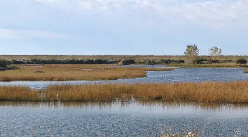
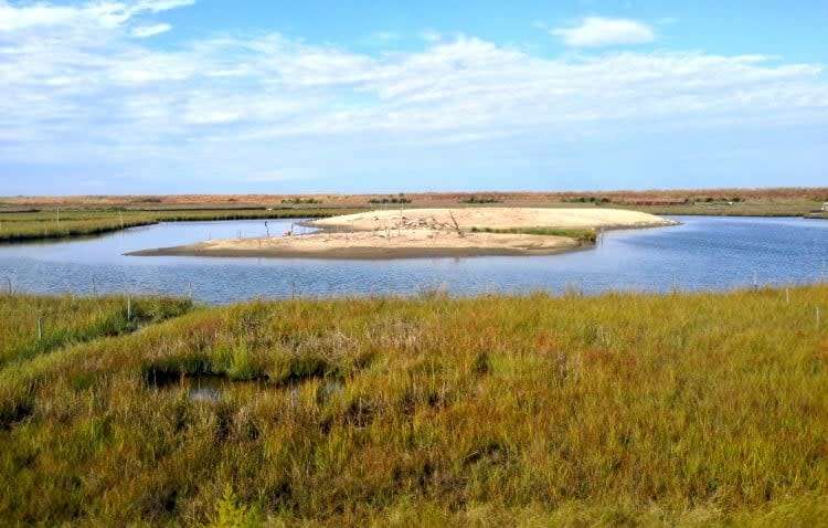
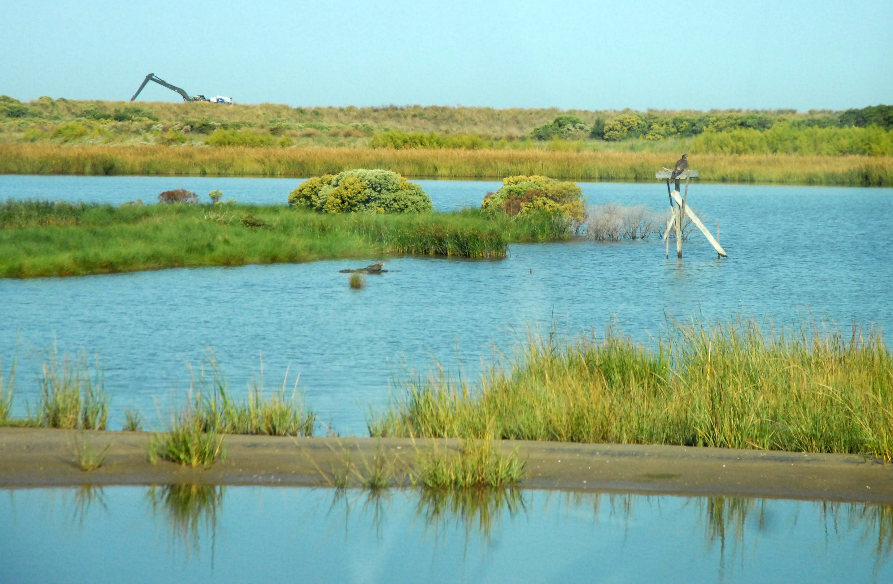
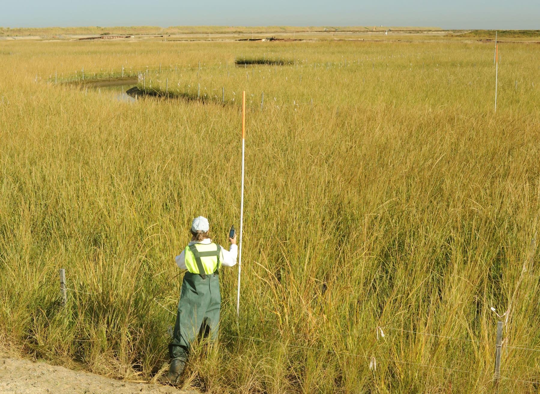
The wetlands that are part of Paul S. Sarbanes Ecosystem Restoration Project at Poplar Island are exceptional for the provision of remote island wildlife habitat, especially for resident and migratory birds, for providing opportunities for outreach and public education, and for the preservation of local heritage. The restoration project in its entirety replaces an island in mid-Chesapeake Bay that was almost completely lost to erosion, having dwindled from 1140 acres in 1847 (the date of one of the earliest accurate maps) to less than five acres by 1990. This project will restore 1715 acres, and will include upland (829 acres), tidal marsh (776 acres), and open water embayment (110 acres) habitat. The tidal marshes include small habitat islands surrounded by tidal creeks that provide nesting habitat for colonial-nesting species, including an abundance of herons, egrets and ibis (shrub-nesters), while waterfowl and passerine birds nest within the marsh platform, diamondback terrapins are abundant in and around the wetlands, and many features enhance fish habitat value. In addition to the wildlife value, the marshes are providing an opportunity to enhance our understanding of restoration ecology through a robust monitoring program following the completion of each marsh, including sediment, vegetation, elevation change, water quality and usage by wildlife. The project has an extraordinary outreach program, providing free tours to the public, school groups and birding groups for approximately half the year. Tours include historical information as well as ecology, integrating the many facets of the restoration project in an approximately three hour tour. In addition to restoring wetland ecosystem services, the project also provides essential placement capacity for dredged material, serving as a beneficial use project and contributing to the economy by helping to keep the Maryland shipping industry viable.
Exemplary Ecosystem Services:
- Aesthetic/cultural heritage value/ provisioning
- Recreation (birdwatching, ecotourism)
- Carbon storage
CONSERVATION STATUS AND THREATS
Public Access: Limited (e.g., permission, supervised, etc.)
Current and Future Threats: Sea-level rise
Conservation status: Other
Adjacent Land Use: Mixed Prairie/Forest
Approximate natural buffer width:
- No Natural Buffer
Beneficial use of dredged material island restoration project co-sponsored by U.S. Army Corps of Engineers and the Maryland Department of Transportation Maryland Port Administration.
The island is expected to be restored by 2044. It is expected to be maintained as an undeveloped island for wildlife habitat. Until 2044 a robust monitoring program provides data and feedback for an adaptive management program, This project will be followed by another in Chesapeake Bay, the Mid-Bay Complex, which will use the lessons learned from ecosystem (including tidal marsh) restoration at Poplar Island, meaning the information derived from the marsh restoration at Poplar Island will have far-reaching effects. And, because Chesapeake Bay is experiencing double the global rate of sea-level rise due to regional subsidence, these marshes are a test-bed for our ability to create tidal marshes that are resilient to high and accelerating sea-level rise.
ECOLOGY
Approximate size: 314 ha (tidal marshes only); 694 ha (total island area)
General wetland characterization:
- Coastal Regularly Flooded Salt Marsh
Adjacent Water Bod(ies):
- Tidal Systems
Name of body of water: Chesapeake Bay
Surficial Geology:
Soils originally formed on the islands include some from the Mattapex and Matapeake series and
consist primarily of deep, moderately well drained, dark-brown soils that are level to gently
sloping. These soils developed on silty marine sediments and consist primarily of silt loams that
retain moisture and are well suited for vegetative growth.
Surface sediments in the Poplar Island archipelago, particularly those subjected to prevailing winds, are influenced by wave action and other erosional forces that have reduced Poplar Island to its current configuration. Sediments in the area of the archipelago range from silts to sand to hard clay....Overall, regional information from such studies indicates that sediments within the vicinity of the Poplar Island archipelago are of low risk of contamination (CBP 1995; Rich Eskin 1995).
Soils:
Fine-grained dredged material from the navigation channels approaching Baltimore Harbor, Maryland, in upper Chesapeake Bay
FLORA AND FAUNA
Dominant flora: The dominant low marsh species is Spartina alterniflora (Sporobolus alterniflorus); the dominant high marsh species is Spartina patens (Sporobolus pumilus). Other common species include Distichlis spicata, Sporobolus cynosuroides, Amaranthus cannabinus
Dominant fauna: Dominant fauna in the marshes include mallard (Anas platyrhynchos), black duck (Anas rubripes), Virginia rail (Anas rubripes), diamondback terrapin (Malaclemys terrapin), seaside sparrow (Ammospiza maritimus)
Rare fauna: short-eared owl (Asio flammeus), American Oystercatcher (Haematopus palliatus), Glossy Ibis (Plegadis falcinellus)
ADDITIONAL INFORMATION:
NOAA 2016 Nekton Surveys Annual Report
Terrapin Monitoring at Paul S. Sarbanes Ecosystem Restoration Project
Poplar Island Spring/Summer Newsletter 2019
CONTACT INFORMATION
Applicant First Name: Lorie
Applicant Last Name: Staver
Email: lstaver@umces.edu
Images