Muscatatuck National Wildlife Refuge
About
CONSERVATION STATUS AND THREATS
Public Access: Yes
Conservation status: National Government Protection
Adjacent Land Use: Agricultural (cropland, orchards, greenhouse)
Approximate natural buffer width: > 100 ft
If Other: National Wildlife Refuge
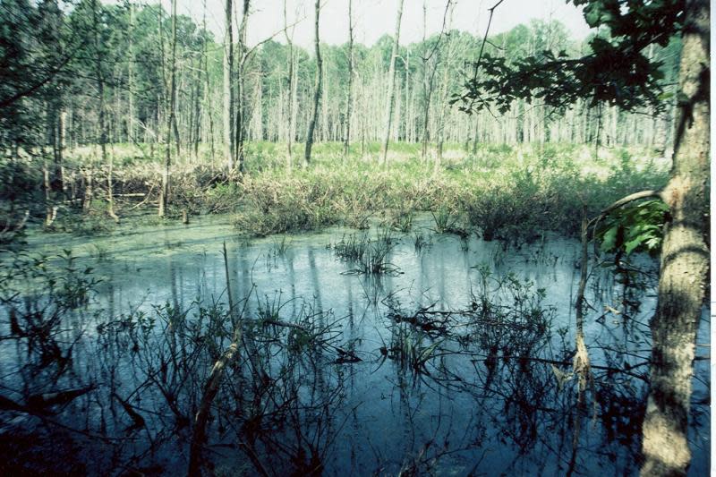
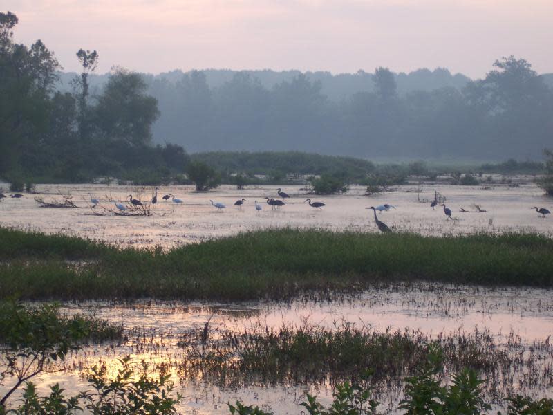
The Muskatatuk National Wildlife Refuge provides habitat for unique wildlife and waterfowl, and preserves rare plants. The shallow water wetlands in the Refuge's Moss Lake area provide seasonal sanctuary for up to 30,000 greater sandhill cranes that recently started wintering in the area. Permanent wetland habitat to support those cranes does not exist anywhere else in the area. The Refuge's Acid Seep Spring Research Natural Area protects one of only seven acid seeps documented in the state, one of which has been destroyed. Wetlands cover approximately 70% of the refuge while approximately 80% of the wetlands that historically existed in Indiana has been destroyed. Wetland habitat in Indiana is extremely valuable for wetland wildlife and plants, many of which are declining in numbers. Muskatatuck NWR is an "island" of wetlands surrounded by farmland.
The refuge also provides outstanding educational opportunities for adults and students to observe and learn about wetlands.
Exemplary Ecosystem Services:
- Maintains ecological connectivity/cohesion
- Aesthetic/cultural heritage value/ provisioning
- Recreation (birdwatching, ecotourism)
- Flood storage/mitigation
- Water quality improvement
- Education
ECOLOGY
General wetland characterization:
- Inland Fresh Seasonally Flooded Basin/Flat
- Inland Fresh Meadow
- Inland Shallow Fresh Marsh
- Inland Open Fresh Water
- Inland Fresh Shrub Swamp
- Inland Fresh Wooded Swamp
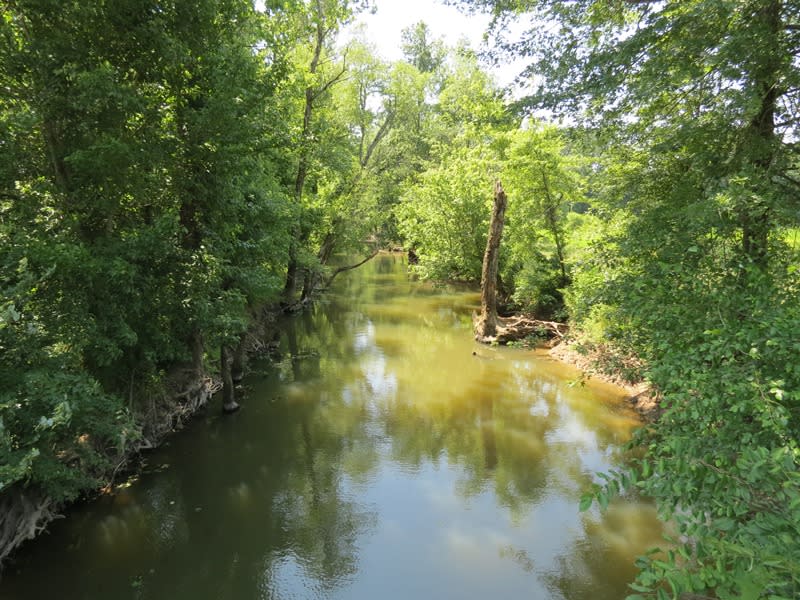
Adjacent Water Bod(ies):
- Lake
- Pond
- Stream
Name of body of water: Mutton and Storm Creeks flow into Muscatatuck River at the south end of the refuge
Surficial Geology: "Muskatatuk NWR is within the Scottsburg lowland physiographic division of Indiana. Geology includes the combinatino of underlying bedrock strata and the unconsolidated soils material deposited by glacial action (pg16)" https://www.fws.gov/midwest/planning/muscatatuck/ccp/chapter3.pdf
Soils: Hydric soils cover 2,962 acres and non-hydric soils cover the remaining 4,797 acres. Soils are grouped into five associations. More information can be found https://www.fws.gov/midwest/planning/muscatatuck/ccp/chapter3.pdf
FLORA AND FAUNA
Dominant flora: Pin oak, swamp white oak, swamp chetnut oak, river birch, silver maple, red maple
Unique flora: Bog bluegrass, climbing milkweed, Walter's St. john wort, smooth white violet, American lotus.
Dominant fauna: Wood duck, white-tailed deer, spring warblers during migration, largemouth bass, bluegill and other fish species, numerous waterfowl species, numerous dragonfly, mollusk, aquatic invertebrate species
Rare fauna: Indiana bat, evening bat, river otter, yellow crowned night heron, american bittern, least bittern, prothonotary warbler, virginia rail, beaverpond baskettail dragonfly; also Federal and state endangered snake species
Images