Mingo National Wildlife Refuge
About
GENERAL INFORMATION
Criteria:
- Protects biological diverse wetland flora, fauna and/or their habitat
- Supports significant numbers of wetland-dependent fauna, such as water birds or fish
- Rare or unique wetland type within its own biogeographical region.
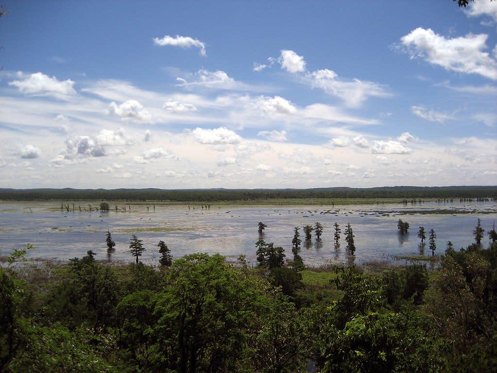
Located in the upper end of the Lower Mississippi River Valley, Mingo National Wildlife Refuge, at 21,592 acres, is the largest remnant of bottomland hardwoods remaining out of an original 2.5 million acres in the Missouri bootheel. The natural area supports three miles of the Mingo River, 42 species of conservation concern and 8,216 acres of bottomland natural communities that support hundreds of native plant species, and many breeding and migratory birds, fish, reptiles, and amphibians. The natural area provides habitat for federally listed species, migratory and resident bird species and places for reptiles and amphibians to overwinter. Mingo National Wildlife Refuge contains a 7,730-acre Wilderness Area designated as Wilderness by Congress under the 1964 Wilderness Act to “…protect and preserve the wilderness character…for the use and enjoyment of the American people in a way that will leave these areas unimpaired for future use and enjoyment as wilderness.”
Because the Mingo National Wildlife Refuge contains remnants of natural community types once native to southern Missouri and contains unique and ecologically important wildlife habitat, this wetland should be considered a national Wetland of Distinction.
Exemplary Ecosystem Services:
- Maintains ecological connectivity/cohesion
- Recreation (birdwatching, ecotourism)
- Flood storage/mitigation
- Education
CONSERVATION STATUS AND THREATS
Public Access: Yes
Current and Future Threats: NONE
Conservation status: National Government Protection
Adjacent Land Use: Rural Residential (non-farm)
Approximate natural buffer width:
- 50-100 ft
- > 100 ft
Other information:
In attached document Missouriensis -- pages 12 and 20 document the finding of Persicaria glabra, and page 18 documents the finding and occurrence of Hydrocotyle ranunculoides.
The Mingo region is rich with American Civil War history and includes the historic site of The Battle of Mingo Swamp. The refuge is home to over 140 identified archaeological sites. These sites represent all Midwest United States cultural periods from the earliest Paleo-Indian through 20th century Western, a period of about 12,000 years
ECOLOGY
Approximate size: 8,734 ha
General wetland characterization:
- Inland Open Fresh Water
- Inland Fresh Shrub Swamp
- Inland Fresh Wooded Swamp
Adjacent Water Bod(ies):
- Pond
- Stream
Name of body of water: Duck Creek Conservation Area
Surficial Geology:
Mingo NWR lies in a basin formed in an ancient, abandoned channel of the Mississippi River. When the Mississippi River shifted east approximately 18,000 years ago, it abandoned its original channel and left behind a basin, now called Mingo Basin. The basin is bordered on the west by the Missouri Ozarks and on the east by a terrace called Crowley's Ridge, a prominent landform in the otherwise flat Mississippi floodplain. The St. Francis River flows from the Ozark Hills into the Advance Lowlands just south and west of the Refuge. When the Mississippi River shifted course, an alluvial fan built up where the St. Francis River entered the lowlands. The alluvial fan, which typically forms at the base of topographic features, acts as a natural levee, slowing drainage through the basin. Several small sand ridges interrupt the otherwise level basin area. The ridges, which vary in shape, may be ancient sand bars deposited by the Mississippi River or sand forced to the surface by earthquakes. The Refuge is in the New Madrid seismic zone, but most of the quakes that have occurred recently are only detectable by sensitive instruments, and there have been no impacts on the Refuge.
If Adjacent to Stream, insert stream order: Kentucky Slough
Soils:
The refuge lies in an abandoned channel of the Mississippi River known as the Advance Lowlands, bounded by the limestone bluffs of Crowley’s Ridge to the south and east, and the Ozark Escarpment to the north and west. The St. Francis River flows from the Ozark Hills into the Advance Lowlands just south and west of the refuge. When the Mississippi River shifted course, joining the Ohio River farther north approximately 18,000 years ago, an alluvial fan built up where the St. Francis River entered the lowlands. The Castor River, north and east of the refuge, developed a similar alluvial fan. These alluvial fans act as natural levees, slowing drainage through the basin.
Bottomland Soils
The most extensive soil type is Waverley Silt Loam, with a grayish brown silt loam surface layer and gray silt loam subsoil that is mottled throughout. A poorly drained acidic soil formed under wet conditions and a high water table, it occupies approximately 50 to 60 percent of the refuge. Falaya Silt Loam occupies a small part of the bottom in areas such as Stanley Creek and Lick Creek. It also borders the upland and the channel of Mingo Creek. Falaya soils have brown silt loam surface layers over grayish brown silt loam underlain at about 40 inches by fray silty clay loam. This soil is somewhat poorly drained, acidic, and subject to flooding or ponding. Organic soils occupy 800 to 900 hundred acres in Rockhouse and Monopoly marshes and consist of dark colored soils derived from organic matter. They were formed under wet marshy conditions in some of the lowest elevations.
Upland Soils
The cherty soils of the steep slopes and stone outcropping along the west side of the refuge are of the Doniphan series. Doniphan soils have light brown cherty silt loam surface layers and red clay subsoils. The ridgetops above Doniphan cherty silt loam are narrow and undulating and have about three feet of loess deposits. The soil is Union Silt Loam. The moderately well-drained Union soils have dark grayish brown silt loam surface horizons that are underlain by brown silty clay loam subsoils. They have fragipan layers at depths of 2.0 or 3.0 feet. On the moderate slopes of the uplands, especially along Highway 51 north of Puxico, there are deep, well-drained soils developed in thick lows. These soils are Loring Memphis Silt Loams and have brown silt loam surface layers and brown silt loam subsoils
FLORA AND FAUNA
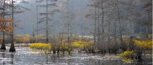
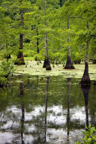
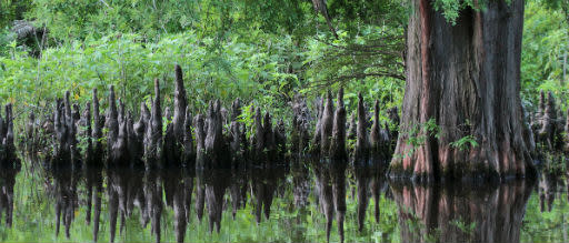
Dominant flora: Mingo NWR vegetation may be broadly divided into wetlands, comprised mainly of bottomland mixed hardwood forests, and upland forest. Within the bottomland mixed hardwood forests, major trees include the sugar maple, northern red oak, pin oak, willow oak, overcup oak, green ash, black willow, cottonwood, silver maple, sycamore, river birch, sweetgum, and swamp white oak. Upland forests are dominated by oak and hickory. Principle trees and shrubs include black oak, post oak, white oak, black hickory, mockernut hickory, elm and white ash, service berry, sumac, sassafras, pawpaw, chinkapin oak, mulberry, and spicebush.
Unique flora: In coordination with Missouri Native Plant Society (MONPS), Missouri Ecological Services biologists aided in the development of a plant list for Mingo National Wildlife Refuge. Five days of survey efforts and field work resulted in the discovery of nearly 500 plant species, 16 of which were rare species that are tracked by the Missouri Department of Conservation. Included among the rarer species was the rediscovery of a smartweed (Persicaria glabra) that had been thought to be extirpated from the state, and two sedges (Carex gigantea and Carex reniformis) that were previously known from only two other sites in Missouri. Also noteworthy was the discovery of 46 species of Carex which is one of the highest numbers of this genus for one locality in the state. The project highlighted a cooperative partnership between Missouri Ecological Services and MNPS that benefited the plant life of Mingo National Wildlife Refuge.
Dominant fauna: Mingo NWR provides habitat for migrating ducks, geese, shorebirds, gulls, terns, loons, grebes, pelicans, cormorants, herons, bitterns, ibises, rails, coots, and swans. Over 95 species of migratory waterfowl have been seen at Mingo. Mingo also provides for other types of migratory and nonmigratory avian species. Over 250 species of birds have been seen at Mingo. Included in this list are the peregrine falcon, endangered whooping crane, and threatened bald eagle. Due to the diverse habitat, Mingo is home for a wide variety of lowland swamp species and upland forest and field species. Mingo is home to over 38 species of mammals, 23 species of amphibians, and 37 species of reptiles.
Rare fauna: Mingo NRW is one of the few places in Missouri where the swamp rabbit (Sylvilagus aquaticus), a larger relative of the eastern cottontail rabbit, is known to occur. In addition to the swamp rabbit, there are currently efforts underway to reintroduce alligator gar (Atractosteus spatula) back to its native habitat in the bootheel of Missouri (including the refuge). Other unique fauna include the lesser siren (Siren intermedia), and amphiuma (Amphiuma tridctylum); though both species are found elsewhere in the state but the refuge is considered a stronghold for these populations. Lastly, the rare black-bellied whistling duck (Dendrocygna autumnalis) has been spotted at the refuge.
ADDITIONAL INFORMATION
Mingo Field Notes – Missouriensis #27
CONTACT INFORMATION
Applicant First Name: Lindsey
Applicant Last Name: Postaski
Applicant E-mail Address: lindsey.postaski@parsons.com
Images