Millbrook Marsh
About
GENERAL INFORMATION
Criteria:
- Protects biological diverse wetland flora, fauna and/or their habitat
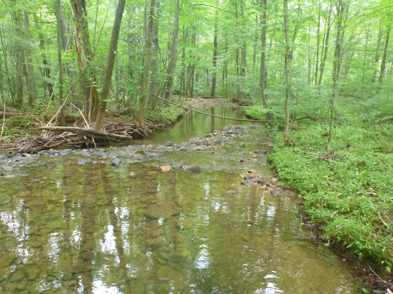
Millbrook Marsh is an exceptional urban wetland. The Marsh educates over 13000 visitors each year from grades K through college and beyond. The wetland collects stormwater from college apartment complexes and cleans the water before it enters in 3 cold water streams -- Spring Run, Thompson Run and Slab Cabin Run. Both Thompson Run and Spring Run flow into Slab Cabin Run before the stream exits the park. Slab Cabin Run is an important for cold water fishery, making Millbrook Marsh an integral to the viability of the fishery.
Exemplary Ecosystem Services:
- Recreation (birdwatching, ecotourism)
- Flood storage/mitigation
- Water quality improvement
- Education
CONSERVATION STATUS AND THREATS
Conservation status: Conservation Easement
Adjacent Land Use: Ranchland (pasture, grazing)
Approximate natural buffer width:
- 50-100 ft
ECOLOGY
Approximate size: 36
Name of body of water: Slab Cabin Run
Surficial Geology: Interbedded limestone and dolimite
If Adjacent to Stream, stream order: 2
Soils:
The geological conditions provide a partial explanation for the existence of the calcareous fen. Fens typically are formed by organic matter accumulation in wetlands primarily fed by groundwater that is high in calcium and bicarbonate ions. Calcite (CaCO3) is often present in the histosols, creating an alkaline reaction and a very mineral rich condition of the calcareous histosols, unlike most organic soils which are acidic (Richardson 1987). The soils of the Millbrook Marsh calcareous fen were sampled in 3 areas (Western Pennsylvania Conservancy 1995). The very wet open fen area had a peat depth of 0.40 m ranging in decomposition from H1 to H9, where H1 is completely undecomposed and H10 is completely decomposed. An interesting point is that the decomposition levels of peat are not found sequentially from the surface to the transition zone before clay. H1 peat was found to 0.10 m, then H2 to 0.25 m, H8 to 0.30, H6 to 0.35 m, and before the transition zone, H9 to 0.40 m. There was silty clay from 0.5 m to 0.65 m and clay from 0.65 m to 0.85 m. The wet open fen area had 0.20 m of H3 peat over a transitional zone from 0.20 m to 0.60 m, then muddy clay from 0.60 m to 0.75 m. and silty clay to 1.00 m. The wet shrub fen area had peat to 0.65 m with H3 peat at the surface to 0.10 m, H4 to 0.20 m, H8 to 0.35 m, and H3 again to 0.50 m. Silty clay was found from 0.65 m to 0.85 m and then silty clay and gravel to 0.90 m.
The residual soils cover the carbonate rocks, the interbedded limestones, dolomites, and sandy dolomites of the Nittany Valley. Chemical decomposition lowers the surface of the rocks and the residuum ranges in thickness up to 30 m (100 ft) on top of them. The soil series found at Millbrook are Hagerstown/Opequon, Dunning, Lindside and Melvin soils (Map 8). Hagerstown and Opequon soils are residual soils developed from limestone and dolomite (Ciolkosz et al. 1980). They have a high capacity for holding moisture and moderately rapid permeability. The other soils on site are alluvial. Dunning soils developed in alluvial materials from uplands of limestone and have the water table at the surface or the soils are ponded for most of the year. They are fine textured with slow permeability and hence, very poorly drained. The Lindside and Melvin soils are probably only 200 to 300 years old and due, most likely, to the erosion caused by logging for charcoal in the early 1800’s (Ciolkosz et al. 1980). They were formed in recent silty alluvium also from limestone upland areas. Both the poorly drained Melvin Series and moderately poorly drained Lindside Series are considered by the Soil Survey Division to be hydric soils (USDA, NRCS 1995).
The soil types occurring on site are depicted in Map 8. Along parts of Thompson Run is a swath of Opequon-Hagerstown, a steeply sloping section with rapid runoff rates due to a grade of 15 to 25%. There is high to moderate erosion potential for this area. Depth to bedrock is shallow and there are limestone outcrops throughout.
At the junction of Thompson Run and East College Avenue, as well as most of the land surrounding the corridor of Slab Cabin Run and Bathgate Spring Run, soils consist of Melvin Silt Loam. Since the slope is merely 0 to 2%, runoff rates are very slow, as are rates of erosion. There is frequent flooding and ponding here, and the water table is seasonally high. This type of soil is commonly found in the flat floodplain of limestone valleys.
To the west of Thompson Run, and on parts of the area previously known as Farm 12, is Hagerstown Silt Loam with a gentle 3 to 8% slope. This soil type and slope is moderately prone to erosion and runoff rates are moderate as well. Sinkholes and clay pans are not unusual for this classification found in valley floors of limestone uplands. Sections of 3 to 8% sloping Hagerstown Silt Loam are found near the Mt. Nittany Expressway as well as along the south edge of the site adjacent to East College Avenue. Some of this section, especially that area that contains the calcareous fen, is probably fill of an as yet unidentified type (PennDOT 1981). It appears that groundwater is filtering through a good portion of the fill, yet continues to support the fen vegetation of Millbrook Marsh. The fen and surrounding vegetation may benefit from removal of this cover of fill and rubble.
Directly adjacent to the Mt. Nittany Expressway is a portion of Hagerstown Silt Loam with a slope of 8 to 15%, yielding moderate to rapid runoff rates and erosion levels. Clay pans and sinkholes are possible here as well. Beside it, also adjacent to the bypass, is Opequon-Hagerstown with a slope of 8 to 15%. The limitations are the same as those for Hagerstown Silt Loam, though in addition, depth to bedrock is shallow.
There is a portion of Opequon-Hagerstown with a severe slope of 25 to 90% along the same edge of the site in which runoff is rapid and erosion high. This area has a very shallow depth to bedrock, and here too, clay pans and sinkholes may occur.
In the triangular area between Thompson and Slab Cabin Runs is found Dunning Silty Clay Loam with a slope of just 0 to 2%. Runoff is very slow and erosion probability is slight except in flood situations. This is, though, a floodplain soil, with potential ponding, frequent flooding, and high water table. Also in this triangular section, on both sides of Slab Cabin Run, are Lindside Soils with a 0 to 2% slope. Lindside Soils are found in the flat areas of floodplains in limestone valleys. Runoff is slow due to minimal grades and erosion occurs only in flood situations. As with the Melvin Silt Loam, Lindside has a seasonally high water table.
One section along the southern edge of Millbrook Marsh is classified as Urban Land. Soil identification was not possible. Runoff is rapid and sinkhole formation a possibility.
Cheryl Joy Lipton, 1998 (http://millbrook.crpr.org/CL-Thesis/4Chapter.html)
FLORA AND FAUNA
Dominant flora: Acer negundo (Box elder), Salix nigra (Black willow), Cornus sericea (Red osier dogwood), Rhamnus sp. (Buckthorn), Sambucus canadensis (American elder), Brassica rapa (Field mustard), Carex lacustris (Lake sedge), Phalaris sp. (Canary grass), Symplocarpus foetidus (Skunk cabbage), Typha angustifolia (Narrow-leaved cattail).
Rare flora: none
Dominant fauna: Mink (Mustela vision), Muskrat (Ondatra zibethicus), White-tailed deer (Odocoileus virginianus), Eastern Painted Turtle (Chrysemys picta picta), Common Snapping Turtle (Chelydra serpentina serpentina), Northern Green Frog (Rana clamitans melanota), Brown Trout (Salmo trutta), Northern Water Snake (Nerodia sipendon sipedon), Eastern Garter Snake (Thamnopnis sirtalis sirtalis), Great Blue Heron, Green Heron, Mallard Duck, Belted Kingfisher, Yellow Warbler, Common Yellow Throat, Yellow-rumped Warbler, Swamp Sparrow, Red-winged Blackbird, Red-bellied Woodpecker, Downy Woodpecker, Hairy Woodpecker, Cooper’s Hawk, Red-tailed Hawk, Turkey Vulture, Pileated Woodpecker, Northern Flicker, Eastern Phoebe, Willow Flycatcher, Eastern Kingbird, Red-eyed Vireo, Tree Swallow, Barn Swallow, Ruby-crowned Kinglet, White-breasted Nuthatch, House Wren, Carolina Wren, Gray Catbird, European Starling, Northern Mockingbird, American Robin, Cedar Waxwing, House Sparrow, Chipping Sparrow, House Finch, American Goldfinch, Eastern Bluebird, Dark-eyed Junco, White-throated Sparrow, Swamp Sparrow, Song Sparrow, Brown-headed Cowbird, Common Grackle, Northern Cardinal, and American Robin.
Rare fauna: none
Images