Cache River Wetlands
About
GENERAL INFORMATION
Criteria:
- Currently a Ramsar Site
- Listed on more than one “valuable wetland” list by natural resource agencies or nongovernment organizations.
- Protects biological diverse wetland flora, fauna and/or their habitat
- Supports significant numbers of wetland-dependent fauna, such as water birds or fish
- Rare or unique wetland type within its own biogeographical region. (Meeting this criteria would include, but is not limited to, wetlands with unique hydrology or chemistry that make it rare within its own region)
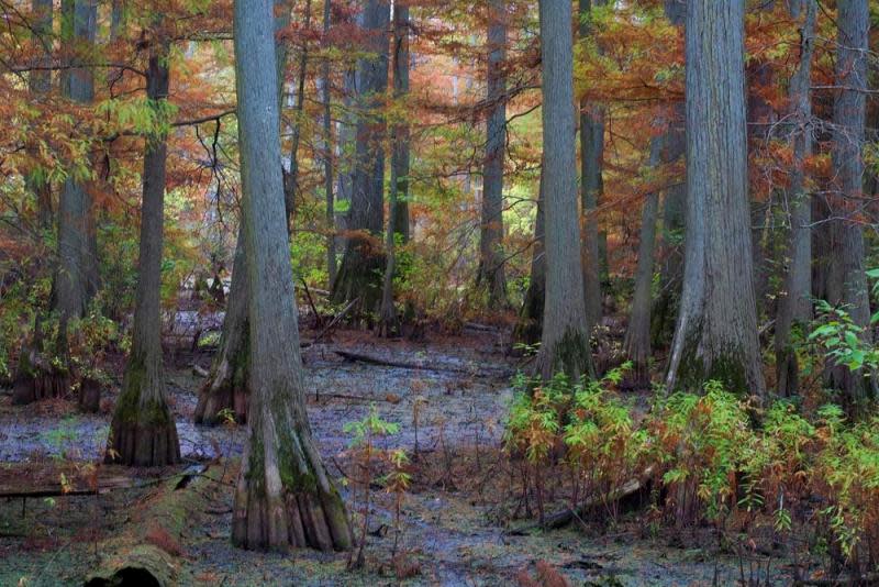
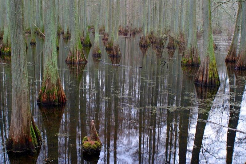
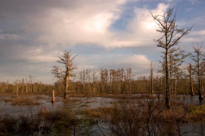
"This river is hidden," said a French adventurer credited with naming the Cache when he spotted its log-jammed mouth on the Ohio in 1702. His words are still true today as the natural features, the hidden treasures of the Cache, these remnants of its past, must be actively sought out to be experienced. The word cache comes from the French and means "something hidden, or stored." In Illinois, our Cache is a treasure trove of biological wonders and a wetland of international significance. The Cache River Basin crosses Southern Illinois, from the Ohio River on the east to the Mississippi River on the west, and is the prehistoric river valley of the Ohio. Referred to in the original United States Land Survey as "inaccessible and a drowned land," the basin marks the geographical point where the last invasion of the sea into the Midwest reached its northernmost limit, and lies only a few miles from the southernmost extent of the continental glaciers. The Cache Basin supports a diverse mixture of forests, grasslands, wetlands, shallow lakes and streams and is the northern limit for cypress-tupelo swamps in the Mississippi Valley.
Post, S. and M. Jeffords. "Treasures of the Cache." The Illinois Steward, June 2006, Vol. 15, No. 1.
Exemplary Ecosystem Services:
- Maintains ecological connectivity/cohesion
- Aesthetic/cultural heritage value/ provisioning
- Recreation (birdwatching, ecotourism)
- Aquifer recharge
- Storm abatement
- Flood storage/mitigation
- Carbon storage
- Water quality improvement
- Education
CONSERVATION STATUS AND THREATS
Conservation status: RAMSAR Designation
Adjacent Land Use: Agricultural (cropland, orchards, greenhouse)
Approximate natural buffer width:
- > 100 ft
If Other: Cypress Creek National Wildlife Refuge and Cache River State Natural Area
ECOLOGY
Approximate size: 16,000+ acres
General wetland characterization:
- Inland Fresh Seasonally Flooded Basin/Flat
- Inland Shallow Fresh Marsh
- Inland Fresh Shrub Swamp
- Inland Fresh Wooded Swamp
Adjacent Water Bod(ies):
- Stream
Surficial Geology: The Cache occupies the ancestral lake bed of the Ohio River. The land is mostly flat with river terraces along the southern edge.
If Adjacent to Stream, insert stream order: Cache River and Cypress Creek
Soils: hydric and alluvial
FLORA AND FAUNA
Dominant flora: bald cypress, water tupelo, overcup oak, various species of duckweed
Unique flora: red iris, American featherfoil, lizard's tail
Dominant fauna: pileated woodpecker, prothonotary warbler, barn owl, extensive waterfowl, great white egrets
Rare fauna: elephant stage beetle, unicorn beetle, diamondback watersnake, copperbelly watersnake
Images